


Roads to Rome
2015 Dec
486.713 routes to Rome, 120cm × 80cm, lambda print / interactive web map
486.713 routes to Rome, 120cm × 80cm, lambda print / interactive web map
Concept/Idea
Benedikt Groß & Philipp Schmitt
Programming/GIS
Benedikt Groß, Philipp Schmitt & Raphael Reimann
Documentation/Text
Data
Routing Engine
Geospatial Analysis
Interactive Maps
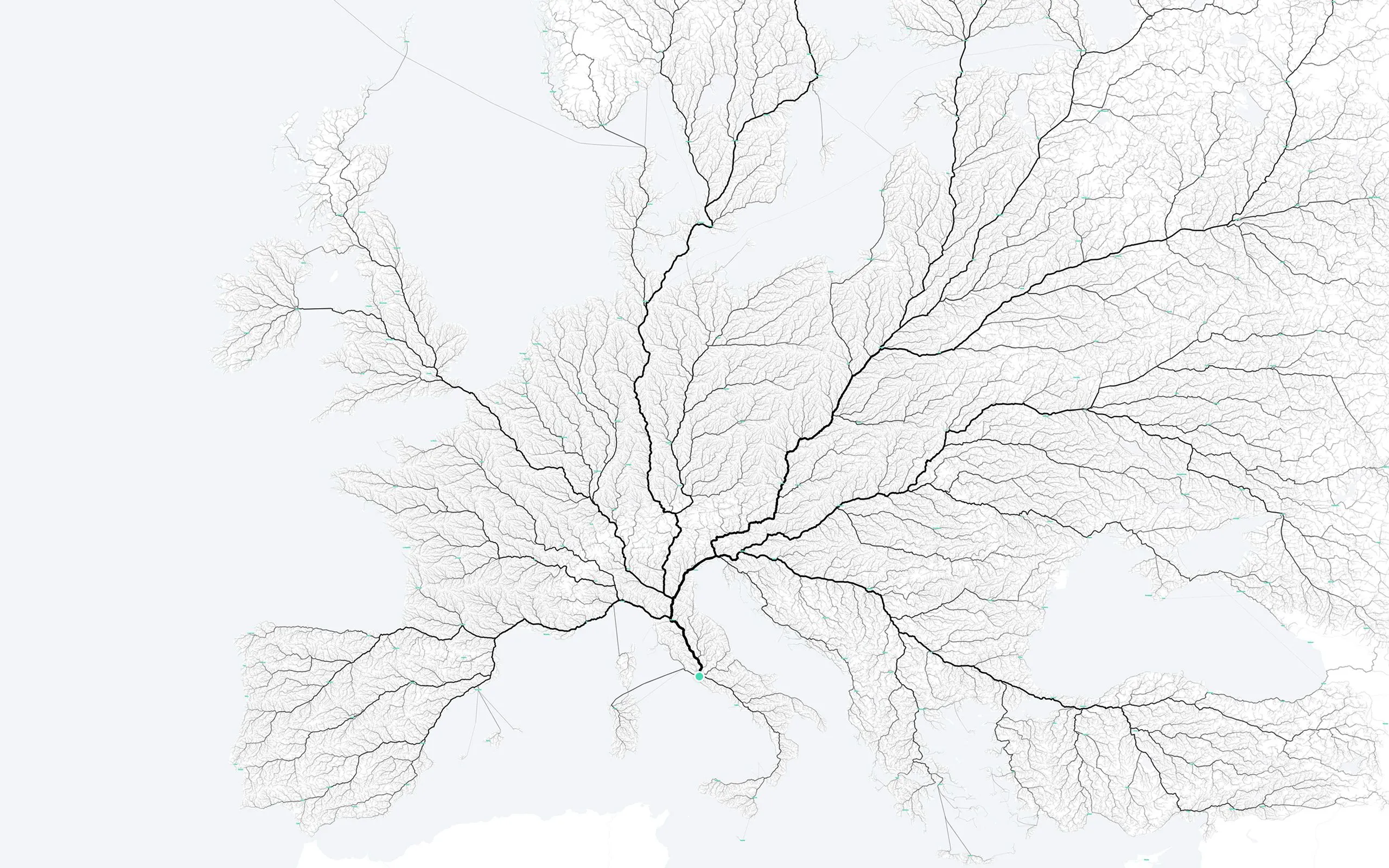
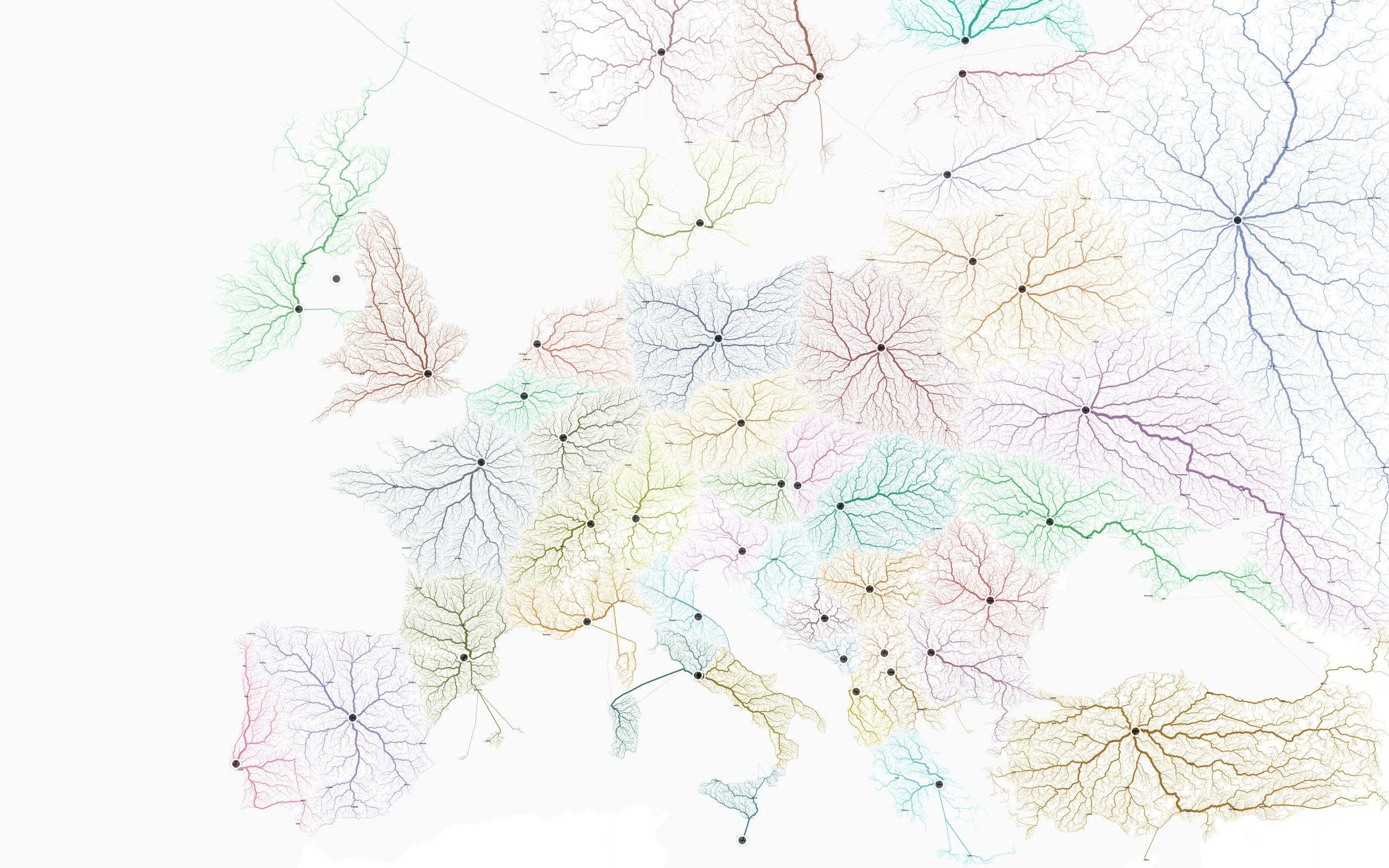
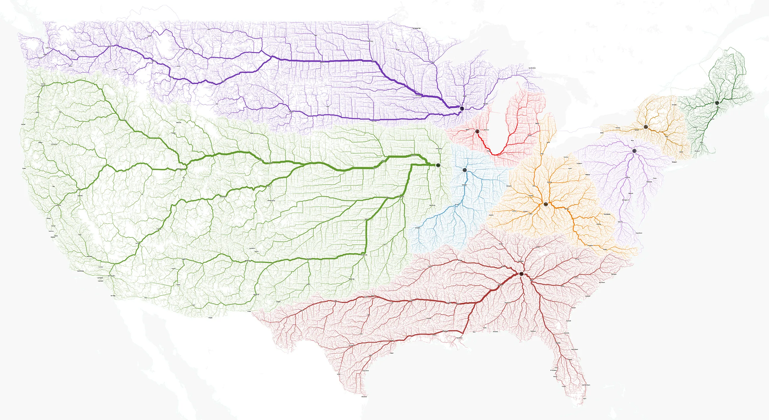
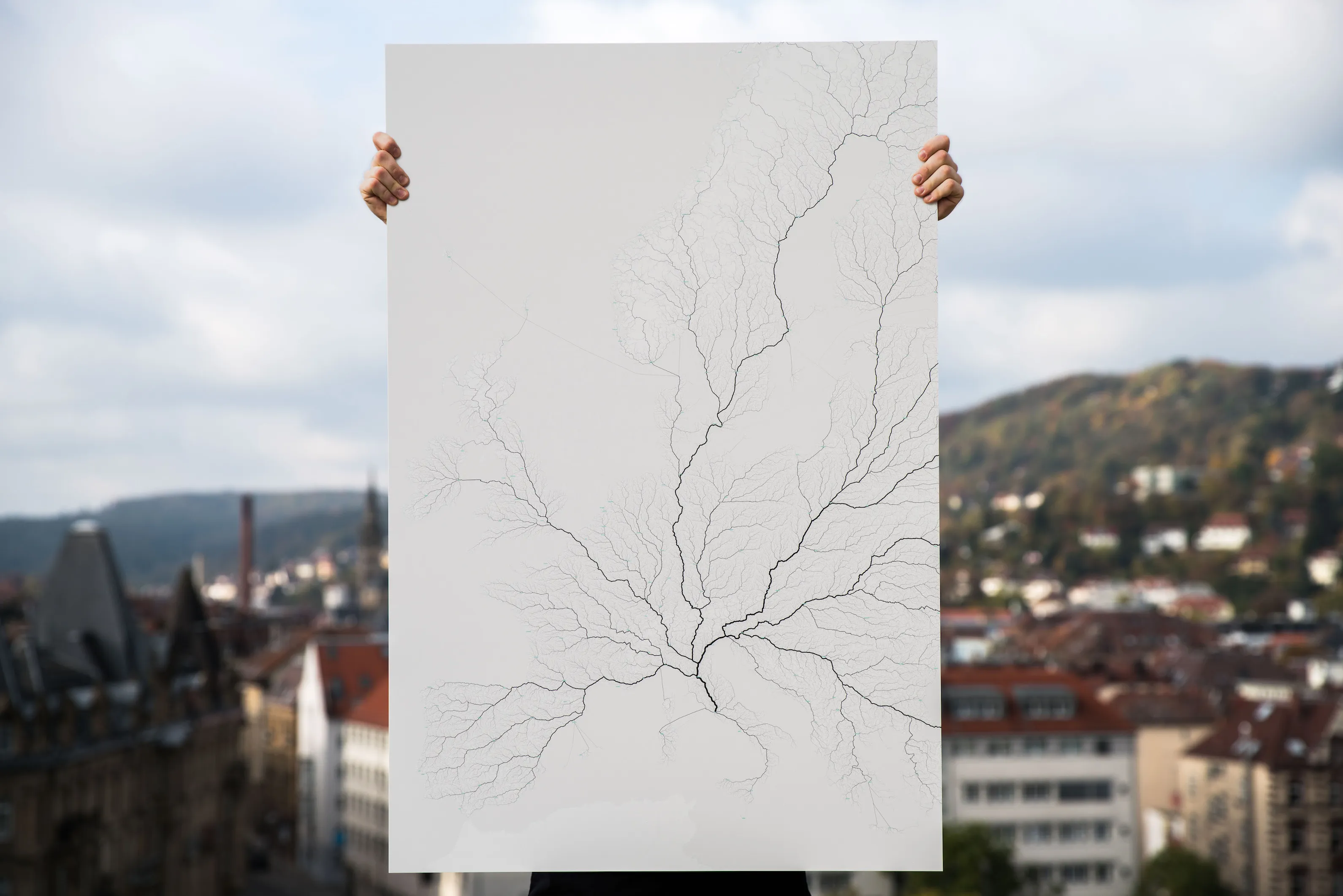
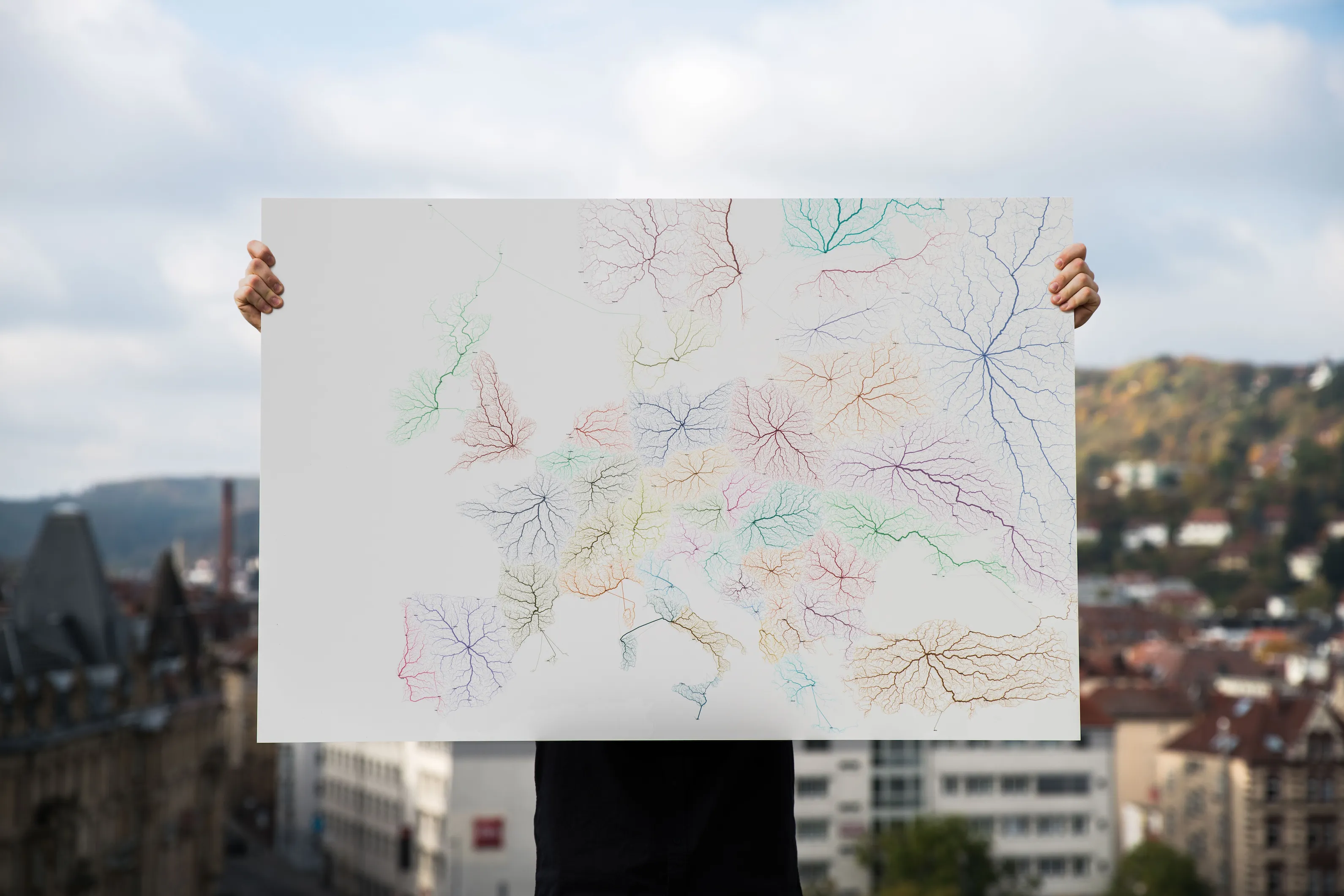
“Roads to Rome” is a data visualization project that explores the idiom, “all roads lead to Rome”. The outcome is both information visualization and data art and unveils mobility patterns at a very large scale. The visualizations were created using routing algorithms on existing street infrastructure from city to continent scale. The resulting images bring insights into the ways in which road infrastructure reflect regional, political and geographical situations.
The project page comes with detailed informations, interactive maps, an “explore” app, media downloads … and can be found under:
The projet uses OpenStreetMap data and the open-source routing engine GraphHopper.
120cm × 80cm, lambda print / interactive web map
120cm × 80cm, lambda print / interactive web map
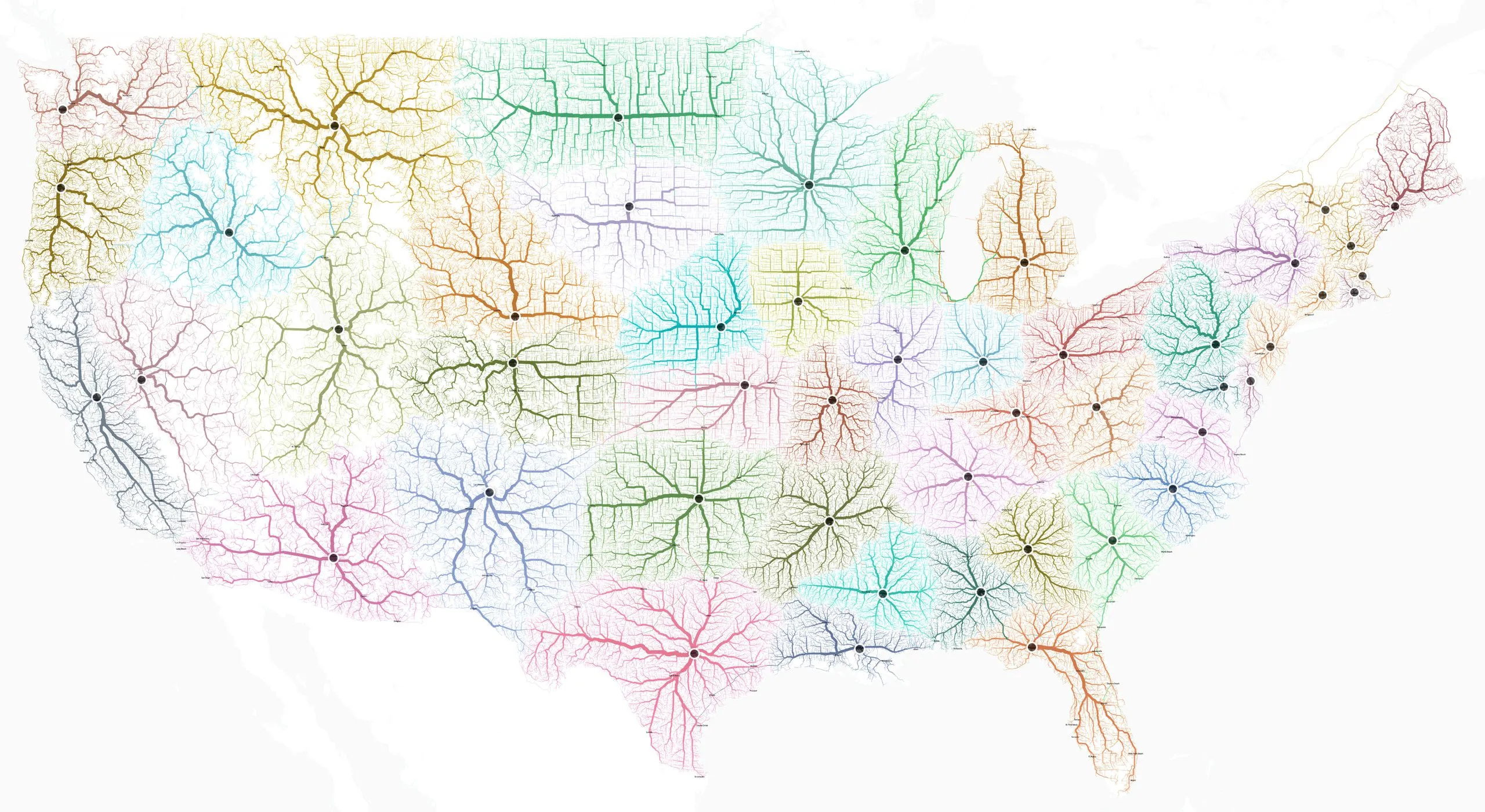
120cm × 80cm, lambda print / interactive web map
120cm × 80cm, lambda print
120cm × 80cm, lambda print
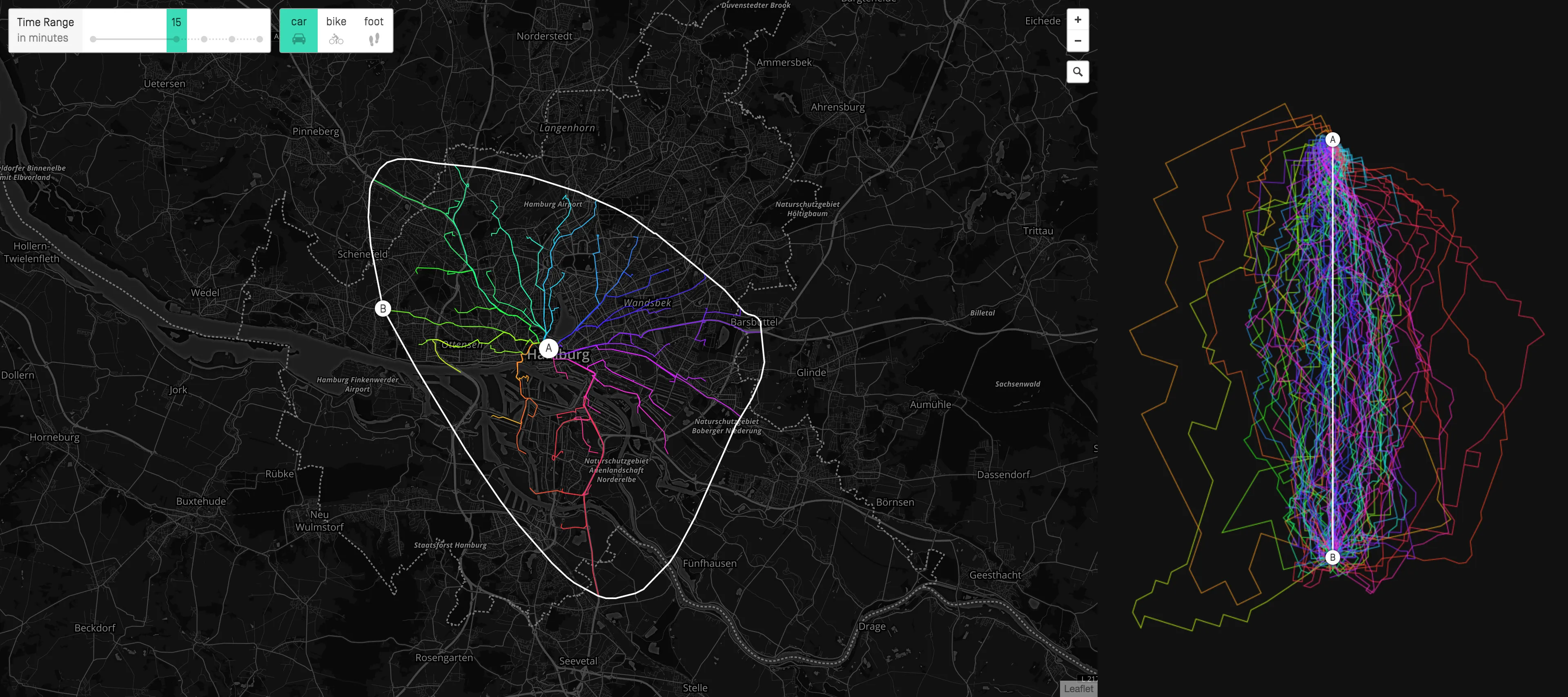
Screenshot of Explore Web App
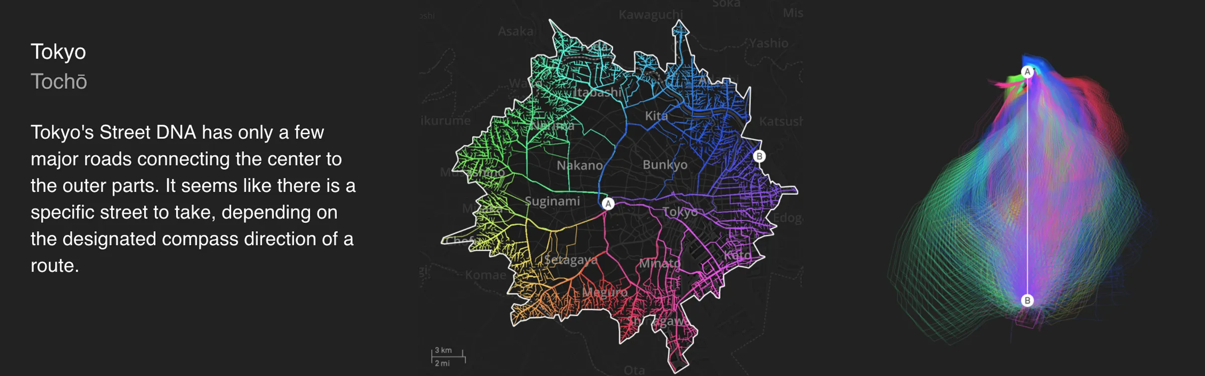
Tokyo, Urban Mobility Fingerprint and Street DNA graphs
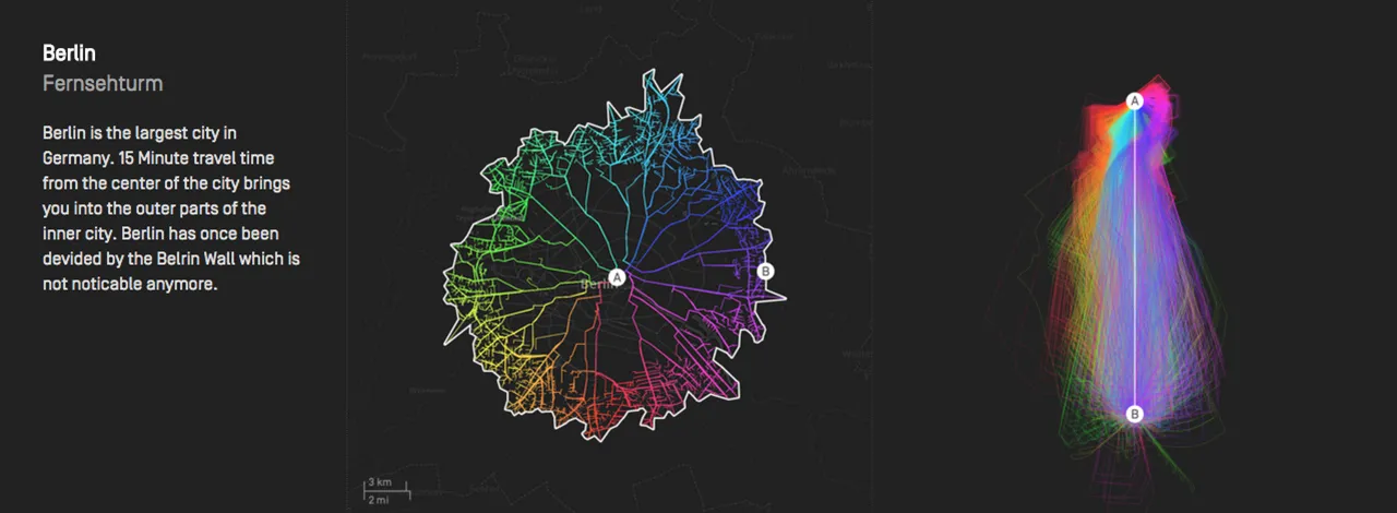
Berlin, Urban Mobility Fingerprint and Street DNA graphs
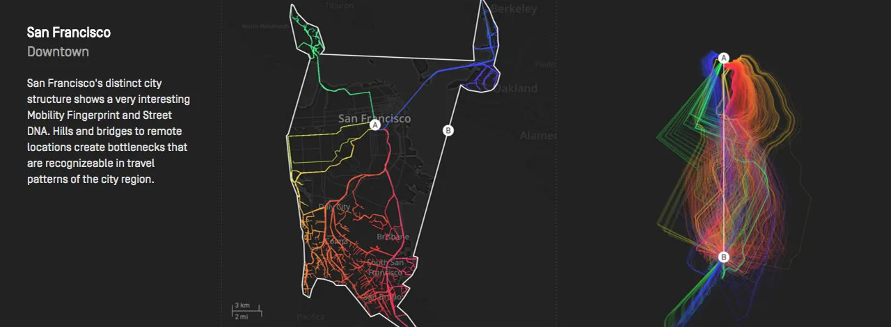
San Francisco, Urban Mobility Fingerprint and Street DNA graphs
Related

Press
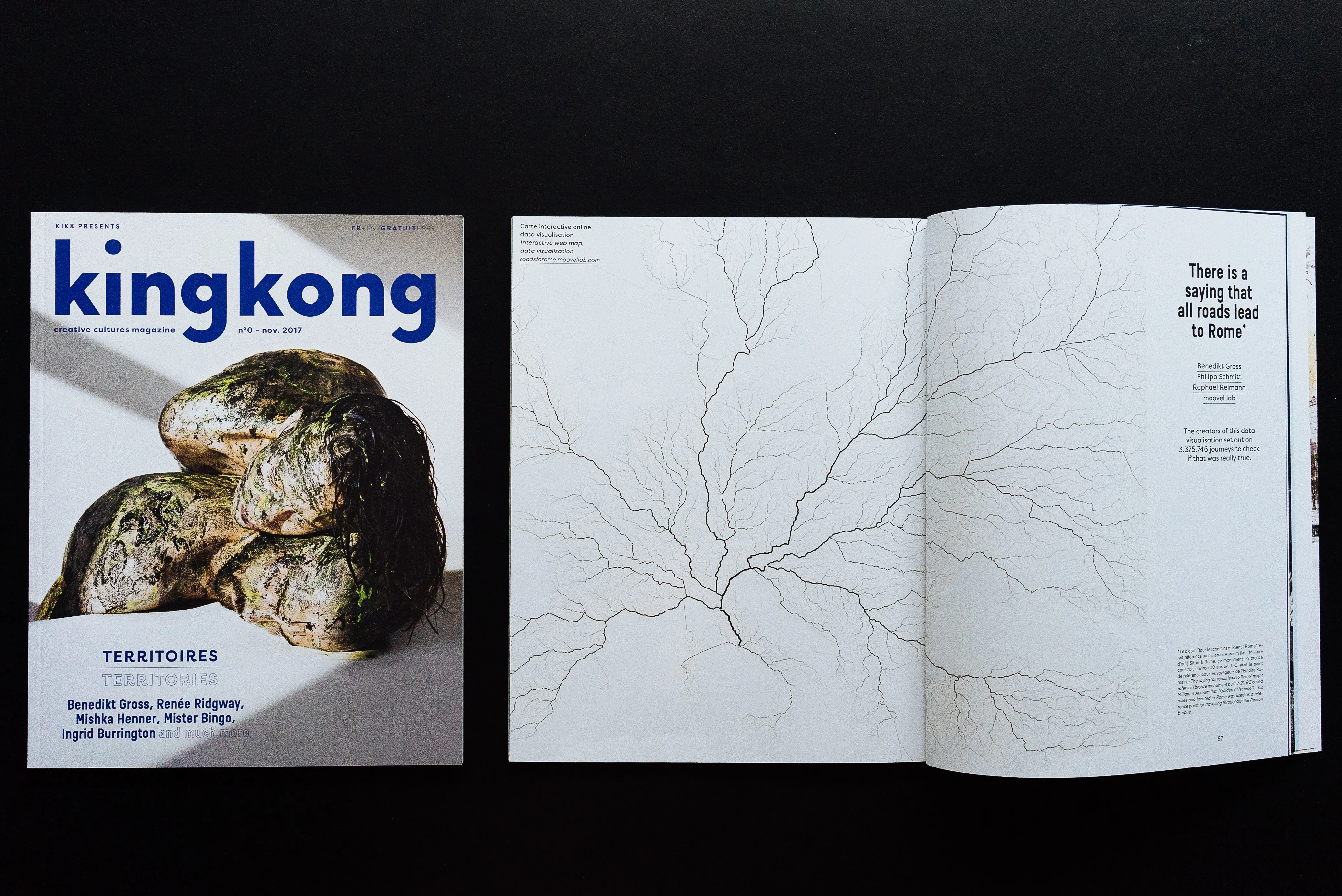
Roads to Rome @ King Kong of KIKK Festival, Issue N°1
2017–11


Press
Roads to Rome @ Repubblica.it
2015–12
Press
Roads to Rome @ Süddeutsche Zeitung
2015–12